Summary
Mountain scenery, ice caves, camping, and more in the Western Cascades.
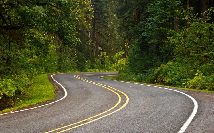
Washington is home to endless mountains, forests, and national parks that will put you in a road-trip state of mind. Abundant winding routes get sightseers off the beaten path, but the Mountain Loop Highway showcasing the famous Cascades is certainly one of the most impressive.
This route, though it’s called a loop, is actually a horseshoe-shaped highway that starts in Granite Falls, swings out eastward to skirt the perimeter of Mt. Baker-Snoqualmie National Forest, then boomerangs back to Darrington, just northeast of Granite Falls. The Mountain Loop Highway is officially 55 miles long and takes about two hours to travel in one direction. It’s open only from late spring to fall because of winter weather in the mountains, making summer—from late May to September—the best time to visit. Consequently, be sure to check the road conditions before you go.
Road trippers have the option of going out and back, soaking in the stunning alpine scenery twice, or making a real loop by traveling back to Granite Falls via Arlington, a shorter but decidedly less scenic option.
Know Before You Go
This highway is one of the best ways to see the Western Cascades, unsurpassed in Pacific Northwestern beauty. It connects two remote cities in Snohomish County, neither bustling nor equipped with accommodations. Nonetheless, many complete the drive as a day trip from Seattle, which is just 50 minutes (without traffic) from Granite Falls. If you drive from Seattle to Granite Falls, along the Mountain Highway Loop to Darrington, then back to Granite Falls via Arlington before returning to Seattle, you should plan for 4.5 to five hours of travel time, excluding stops.
However, there are many photo ops, hikes, and other reasons to stop along the route, incentivizing road trippers to extend their journey over a couple of days. In good weather, camping presents a wonderful option that allows for a full wilderness experience. Popular places to pitch (or park) include Verlot Campground, about 15 minutes from Granite Falls, and Bedal Campground, located halfway between Granite Falls and Darrington on the Mountain Loop Highway. Both are operated by the National Forest Service and are open seasonally, typically from May to September.
For a slightly more unique experience, consider visiting the Treehouse Place at Deer Ridge, a tucked-away oasis located just 15 minutes south of Granite Falls.
Road Conditions
Although beautiful, navigating this scenic highway isn’t always easy. After reaching Barlow Pass, about 45 minutes into the drive, the two-lane road ends, giving way to gravel. While it’s drivable if you take your time, always exercise caution. Due to winter conditions, the road typically closes from around September through April, often into May.
It’s essential to remember that snow and ice can occur even outside of winter. Therefore, even when the road is open to traffic, you should remain cautious. Always check the weather and road conditions before embarking on your journey and plan accordingly.
Where to Stop Along the Mountain Loop Highway
Before hitting the highway, stock up on road trip snacks and picnic supplies at the Granite Falls IGA. There are no dining options along this remote stretch, but there are ample places to pull over and claim a picnic bench.
About 30 minutes from Granite Falls, the first major attraction you’ll encounter is Big Four Mountain. At 4,000 feet, its north face is prominently visible from the Mountain Loop Highway. The mountain was named after a giant “4”-shaped snow patch located on its east face. Be sure to stop for a photo at this stunning landmark before continuing on to Big Four Ice Caves.
The ice caves, located about 38 minutes into the drive, are a natural phenomenon created by a mixture of snow runoff, waterfalls, and windy conditions. The mile-long hiking path leading to them is well-maintained and accessible for those comfortable with a short hike. However, once you reach the caves, you will need to admire them from a distance, as entering or climbing atop them is strictly prohibited.
After exploring Big Four, hop back in the car and drive another eight minutes to the old mining town of Monte Cristo for a glimpse of local history. In the late 1800s, this town teemed with people seeking their fortunes. Unfortunately, flooding and miscalculations about what could be mined left the town in decline. Today, visitors find a ghost town that invites reflection on life a hundred years ago.
Following your visit to Monte Cristo, prepare for a longer stretch of scenic driving. The next point of interest is about 50 minutes away and is perfect for a snack break. White Chuck Overlook features a picnic area and restroom facilities alongside breathtaking panoramic views. If you’re fortunate, you might even spot a mountain goat in late summer or early fall.
From White Chuck Overlook to the end of the Mountain Loop Highway in Darrington is just a 15-minute drive. In warm weather, consider whitewater rafting here or hiking any of the numerous trails that showcase picture-perfect mountain vistas.
Darrington to Granite Falls Via Arlington
If you feel that one trip around the Mountain Loop Highway is enough for one day, you can opt for a shorter route back to Granite Falls via State Route 530. Unlike the Mountain Highway Loop, which is shaped like a horseshoe, this return route takes you through the small town of Arlington.
Arlington, nicknamed “the Shingle Capital of the World,” offers limited attractions, featuring only a casino and a kangaroo farm. However, you can enjoy a pint at Bad Dog Distillery or a slice of Stilly Diner‘s pie of the day before heading back to Granite Falls.
The route from Arlington to Granite Falls spans around 14 miles, taking about 25 minutes along the residential Jordan Road, which follows the winding South Fork Stillaguamish River.


