Summary of Walking Routes in Ireland
- The Beara Way: West Cork’s Finest Route
- The Burren Way: Desolation and Wild Coastlines
- Carrauntoohil and Croagh Patrick: A Day of Climbing
- The Dingle Way: A Classic Trek in County Kerry
- The Tain Way: Through the Cooley Mountains
- The Ulster Way: Around All of Northern Ireland
- The Wicklow Way: Hillwalking on Dublin’s Doorstep
Walking is a popular activity in Ireland, enjoyed by both locals and tourists. Here, you will discover seven of the best walking routes, including six well-known long-distance paths and a suggestion for two-day trips up Ireland’s iconic mountains. Always prioritize safety and be sure to wear appropriate walking gear.
The Beara Way: West Cork’s Finest Route

The Beara Way takes you through the stunning landscapes of the Beara peninsula, where you can enjoy breathtaking mountains and secluded beaches. This route spans 196 km, with a suggested shorter passage of 116 km that can be completed over six days. Expect to face steep inclines and mix of trail conditions, with roughly 40% on paved roads. Always carry a map, preferably the OSI Discovery Series Sheets 84 and 85 for navigation.
- Day 1 – 16 km from Glengarriff to Adrigole (approx. 5 hours).
- Day 2 – 22 km from Adrigole to Castletownbere (approx. 6 hours).
- Day 3 – 12 km from Castletownbere to Allihies (approx. 3 hours).
- Day 4 – 20 km from Allihies to Eyeries (approx. 6 hours).
- Day 5 – 22 km from Eyeries to Lauragh (approx. 6 hours).
- Day 6 – 24 km from Lauragh to Kenmare (approx. 6 hours).
Always carry essential supplies like maps, a compass, food, and drinks for the duration of your hikes.
The Burren Way: Desolation and Wild Coastlines in County Clare

The Burren Way stretches 123 km and is best undertaken over approximately 5 days. Although physically manageable, the striking lunar landscapes can be mentally challenging. The trail conditions are generally good and well-signposted. For maps, consider obtaining the OSI Discovery Series Sheets 51 and 57.
- Lahinch to Doolin – 18 km coastal walk (approx. 4 hours).
- Doolin to Lisdoonvarna – 12 km inland path (approx. 3 hours).
- Lisdoonvarna to Ballyvaughan – 25 km through the Burren (5 to 6 hours).
- Ballyvaughan to Carron – 25 km inland (5 to 6 hours).
- Carron to Corofin – 18 km through a less appealing landscape (3 hours).
Wear bright clothing for safety, as there are areas without food or drink options along the route.
Carrauntoohil and Croagh Patrick: A Day of Climbing

If you’re seeking adventure, Carrauntoohil stands as Ireland’s highest peak at 1,038 m, while Croagh Patrick is known for its pilgrimage significance. Climbing Carrauntoohil typically requires around 6 to 7 hours, including ascent time. The trails are varied, with the Devil’s Ladder being notably challenging. Ensure you’re equipped with the OSI Discovery Series Sheet 7 when navigating this area.
Climbing Croagh Patrick, often referred to as “Ireland’s holy mountain,” can also be done in a day. While the ascent and descent take around 4 hours total, feature steep inclines. Conditions on the trail can vary significantly, and sturdy footwear is essential. During popular pilgrimage days, expect larger crowds.
The Dingle Way: A Classic Trek in County Kerry

The Dingle Way spans 168 km and is ideal for those looking to escape the tourist crowds. It is typically completed in a week. The trail conditions are good, complemented by effective signposting. Navigate using the OSI Discovery Series Sheets 70 and 71 for the best experience.
- Day 1 – 18 km from Tralee to Camp.
- Day 2 – 17 km to Annascaul.
- Day 3 – 21 km to Dingle, involving steep terrain.
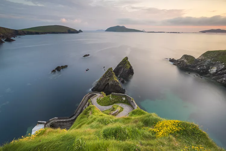
- Day 4 – 20 km from Dingle to Dunquin.
- Day 5 – 24 km from Dunquin to Cuas.
- Day 6 – 18 km to Cloghane.
- Day 7 – 25 km from Cloghane to Castlegregory.
- Day 8 – 25 km back to Tralee.
For accommodations, make arrangements ahead of time, especially between Cuas and Cloghane during inclement weather.
The Tain Way: Through the Cooley Mountains in County Louth

The Tain Way covers approximately 40 km and is suitable for a two-day hike. This route reveals the hidden beauty of the Cooley peninsula, featuring moderate challenges in ascents and mixed trail conditions. The OSI Discovery Series Sheet 36 is recommended for navigation.
The Ulster Way: Around All of Northern Ireland

The Ulster Way is arguably the longest and most challenging waymarked route in Ireland, encompassing 1,000 kilometers of diverse trails. While it can be daunting, the entire trail is generally well-maintained and signposted. Recommended sections include the tranquil Lagan Towpath and stunning Causeway Coast Way.
The Wicklow Way: Hillwalking on Dublin’s Doorstep

The Wicklow Way, a popular trail beginning just outside Dublin, is renowned for its lush landscapes, waterfalls, and scenic bogs. Spanning 127 km, it typically requires a week to complete. Though manageable with experience, prepare for some strenuous sections and variable trail markings.
- Day – Marlay Park to Knockree – 21 km – 7 Hours
- Day – Knockree to Roundwood – 18 km – 6–7 Hours
- Day – Roundwood to Laragh (Glendalough) – 12 km – 4 Hours
- Day – Laragh to Glenmalure – 14 km – 4–5 Hours
- Day – Glenmalure to Moyne – 21 km – 7 Hours
- Day – Moyne to Shillelagh – 21 km – 7 Hours
- Day – Shillelagh to Clonegall – 19 km – 6 Hours
Note that weather changes can occur rapidly in the Wicklow Mountains, so bring appropriate clothing and gear to ensure a safe hiking experience.


