Explore Crystal City Maps in Arlington, VA

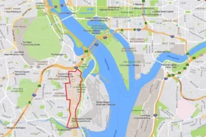
This map shows an overview of Crystal City, Virginia, a neighborhood that is located just over the Potomac River from Washington, DC, between Ronald Reagan National Airport and US Route 1 (Jefferson Davis Highway). The area features a premier shopping mall and is convenient to many hotels, restaurants, and popular tourist attractions. Located in Arlington, Virginia, Crystal City offers a great alternative place to stay while visiting the nation’s capital.

Read More

Ultimate Guide to Maps and Directions for The Pentagon and Pentagon City Mall

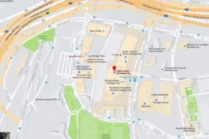
The Pentagon is strategically situated off of I-395 on the Virginia side of the Potomac River. It lies just east of Arlington National Cemetery and northwest of Ronald Reagan National Airport. The most efficient way to reach the Pentagon is via Metrorail. It is important to note that there is no public parking at the Pentagon. Visitors can utilize parking at the Pentagon City Mall (The Fashion Center at Pentagon City) and conveniently walk to the entrance through a pedestrian tunnel. For detailed information on visiting the Pentagon, refer to Pentagon Tours – Reservations, Parking and Visiting Tips. The shopping mall, located at 1100 South Hayes Street, Arlington, VA, features a vast array of retail stores and dining options.

Read More
Back To Top