Summary
Located in central Colorado where the foothills of the Rocky Mountains meet the Great Plains, Boulder is a fantastic year-round destination for outdoor activities. Moreover, the city offers a variety of hiking opportunities within just 10 minutes.
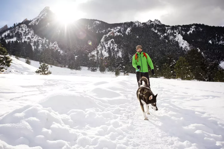
Although the winter months may present more challenging hiking conditions compared to the short summer hikes, hiking during the off-season in Boulder can be equally rewarding. Fortunately, Colorado’s winters are generally mild, allowing hikers to discover areas with minimal snow, especially at lower altitudes.
The following trails provide some of the best hiking experiences around Boulder, especially in winter when the trails are less crowded, consequently enhancing your hiking adventure.
Flatiron Trails at Chautauqua

The Flatirons are an iconic feature of Boulder’s skyline, stretching northwest toward the Rocky Mountains. The Flatiron Number One trail offers a relatively quick hike to the top.
While the trek can become somewhat strenuous near the ridge’s peak, the two-mile hike typically takes about two hours to finish. Most of the year, the abundant sunlight keeps snow levels manageable, and the views from the summit of downtown Boulder and the Front Range are breathtaking.
Getting There: From downtown Boulder, take Broadway (Highway 93) to Baseline Road and turn by Chautauqua Park onto Kinnikinic Road. You can park at the Chautauqua Ranger Cottage and head toward the Bluebell-Baird Trail junction. Bear left, then take an immediate right, following signs for Flatiron #1.
Royal Arch at Chautauqua

Another excellent winter hike available from the Chautauqua Trailhead is a journey to the Royal Arch. Just a mile and a half along the Bluebell Mesa Trail (starting at the Chautauqua Ranger Cottage), this impressive sandstone arch offers stunning views of the surrounding plains.
A round trip to the Royal Arch takes about two hours year-round; however, some sections of the trail may be slippery and slushy in winter, potentially extending your hike. Nevertheless, the trail remains relatively easy to traverse despite the 1,400 feet in elevation gain.
Getting There: Unlike the Flatiron Trails that disperse earlier, the Royal Arch is a significant stop on the Bluebell Mesa Trail, so be sure to follow the marked signs to locate it. You can take a marked loop back to the Chautauqua Ranger Cottage to complete your hike.
Eldorado Canyon

Located just outside Boulder, Eldorado Canyon is a tranquil, accessible gem with numerous options for winter hiking and rock climbing. The area features trails of varying difficulty, providing great views of the continental divide for those who reach higher elevations.
You can often enjoy the trails during the winter months with minimal crowds. While light to moderate snowfall does occur in this area, the Bastille Trail and Fowler Trail remain relatively easy to navigate even in snowy conditions.
Getting There: From downtown Boulder, head south on Broadway (Highway 93) for about 5 miles. Upon reaching the stoplight at Highway 170 (Eldorado Springs Drive), turn right and follow the road through Eldorado Springs. You’ll arrive at the entrance of the state park, where you can find signs leading to parking and trailheads.
Betasso Preserve
Located just a few minutes outside Boulder, Betasso Preserve offers panoramic views from trails nestled between Sugarloaf and Four Mile Canyons.
The Benjamin Loop is a well-kept 2.4-mile path ideal for casual hikers or mountain biking. Various other trails include the challenging Batasso Link (1.3 miles), the moderate Canyon Loop (3.3 miles), and the Blanchard Trail leading to Blanchard Cabin.
Getting There: From Boulder, take Highway 119 (Canyon Road) west for 6 miles before turning right on Sugarloaf Road. Continue on Sugarloaf for approximately a mile, then turn right onto Betasso Road, which leads straight to the preserve and its trailhead.
Red Rocks Trail at Settler’s Park
This well-known hiking location is often confused with Red Rocks Park and Amphitheater in Morrison, closer to Denver. However, Settler’s Park is near downtown Boulder and offers trails for hikers of all skill levels.
The Red Rocks Trail features multiple routes, but the most beginner-friendly option is roughly a half-mile long starting from Settler’s Park Trailhead. In less than an hour, you can complete most of the trail, which reaches an elevation of about 300 feet, providing stunning views of the city.
Getting There: From Boulder, travel west on Boulder Canyon Drive for less than a mile before taking a right turn onto Pearl Street, which leads directly to Settler’s Park. There are parking facilities and ample street parking along Pearl Street, though the winter months often see fewer fellow hikers.


