Summary
Opotiki to Whangaparaoa Bay
One of the most beautiful driving tours in New Zealand – and perhaps in the world – is around the East Cape of the North Island. This follows State Highway 35, commonly known as the Pacific Coast Highway. The route takes in the easternmost point in New Zealand and starts at the Bay of Plenty town of Opotiki, ultimately leading to Gisborne City in Poverty Bay. This article describes the first leg of the trip, from Opotiki to Whangaparaoa Bay, covering a distance of approximately 120km.
This is a remote countryside region. In addition to the stunning scenery, the area is steeped in Maori history, and the influence of Maori culture remains highly evident. The route is populated almost entirely by Maori villages and settlements.
Planning Your Trip
This is one of the most isolated parts of the North Island, so traveling through it requires careful planning. There are no regular bus services, making car travel the only practical means of transport. However, with so many breathtaking sites along the way, you will want to take your time to enjoy the journey.
The total distance of the trip from Opotiki to Gisborne is 334 kilometers. Nonetheless, due to the winding roads, it is wise to allocate a full day for this journey. Accommodations and dining options along the route are extremely limited, particularly on the first half of the trip from Opotiki. Therefore, if you plan to stay overnight, it is essential to arrange your accommodations in advance, as many locations may be closed for considerable portions of the year.
Although most of the route is well-sealed, many sections are in poor condition. Consequently, travelers should exercise extreme caution while driving through this stunning yet challenging terrain.
Additionally, ensure you refuel your vehicle in either Whakatane or Opotiki, as fuel stops are sparse and may not always be open. It’s also advisable to have some cash on hand since options for using ATMs or EFTPOS are limited.
Prepare yourself—this will be an unforgettable trip!
Opotiki
This small yet vibrant town offers numerous points of interest.
Omarumutu (12.8km)
A small Maori village with a marae. The War Memorial Hall showcases some of the finest examples of Maori art in New Zealand.
Opape (17.6km)
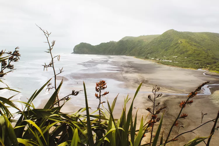
Of historical significance, this is the landing location of several early Maori canoes. A delightful walk from the beach to the top of the hill yields spectacular coastal views.
Torere (24km)
Home to the local Ngaitai tribe, this settlement features numerous examples of richly decorative Maori art. Notably, the church displays remarkable artwork, while the carvings serve as the gateway to the local school. Although the beach is not suitable for swimming, it provides lovely picnic areas and scenic walking opportunities.
Motu River (44.8km)
After traveling through Maraenui, the road heads inland before reaching a bridge that crosses the Motu River. This 110-kilometer long river flows through some of New Zealand’s most pristine native forests. Stopping at the bridge offers an opportunity to appreciate the beauty of the surrounding area.
The only way to access this forest river area is by the river itself; jet boat tours are available on the eastern side of the bridge.
Omaio (56.8km)
This picturesque bay features picnic spots towards the western end (be sure to turn sharply left at the store upon entering the bay). The nearby marae also showcases exquisite Maori carvings at its gateway.
Te Kaha (70.4km)
Originally a whaling settlement, Te Kaha reflects the historical hunting of whales along this coastline during the 19th and 20th centuries. Evidence of this activity can be observed at the nearby Maraetai Bay (also known as School House Bay), where a whaleboat is displayed at the Maungaroa Marae, visible from the road.
Whanarua Bay (88km)
As you approach this bay, you may notice a warm, sunny climate enhanced by a distinctive soft light that adds to the area’s magical quality. This unique microclimate makes this stretch of coastline one of the finest in New Zealand.
A macadamia orchard with an adjoining cafe offers the rare delight of a coffee experience here.
Raukokore (99.2 km)
A small church situated on a promontory beside the sea creates a spectacular sight at this beach. It serves as a poignant reminder of the significant influence that Christian missionaries had on the Maori in the early years of European contact. The beautifully maintained church remains in use, and its remarkable location must be seen to be believed.
Oruaiti Beach (110km)
Often cited as the loveliest beach along the entire Pacific Coast Highway, it invites visitors to relax and enjoy its beauty.
Whangaparaoa (Cape Runaway) (118.4km)
This location marks the boundary of the Opotiki district and holds immense significance to the Maori people; it was here that, in 1350 AD, two important canoes – the Arawa and the Tainui – first arrived in New Zealand from the ancestral homeland of Hawaiki. It is also here that the Maori staple vegetable, kumara, is believed to have been first introduced to New Zealand.
This marks the end point of the coastal drive for this section of the route. However, reaching the northernmost point of the East Cape by road is not possible. The route then moves inland, transitioning to different terrain; although you’ve traveled 120km, there remains over 200km to reach Gisborne!


