Summary
Walking Across the Narrows Bridge in Tacoma
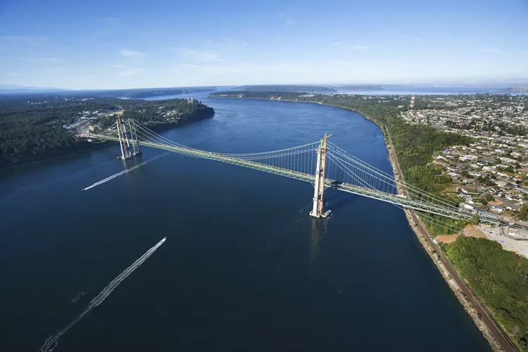
Walking across the Narrows Bridge in Tacoma is one of the many urban hikes or walks that you can enjoy right in the city limits. It stands out as one of the best walks due to its stunning views from 200 feet above the Puget Sound. This scenic route provides great opportunities to observe wildlife, mountains, and expansive skies, although it’s advisable to choose days with blue or mildly cloudy weather for the best experience. This paved path travels along the newer of the two bridges that crisscross this picturesque area.
This newer bridge, built in 2007, was designed to alleviate the heavy traffic that once plagued the older bridge connecting Tacoma and Gig Harbor. The pedestrian and bike path are located on this newer bridge, while the original structure does not accommodate foot traffic.
How to Get Onto the Bridge
If you’ve never walked the Narrows Bridge before, locating the nearest parking might not be as intuitive as you think. The bridge path starts on Jackson Avenue, but parking can be tricky due to the busy nature of that street. Opt for parking in one of the nearby neighborhoods, with War Memorial Park being the ideal starting point. This park is home to one of the largest collections of memorials in the Seattle-Tacoma area.
To enter the park, use 6th Avenue and N. Skyline Drive, conveniently located next to the Swasey branch of the Tacoma Public Library and Pao’s Doughnuts. Parking is free, allowing you to enjoy a leisurely stroll through the park before reaching the bridge. As you approach the park’s far side, the bridge will come into view. Cross Jackson Avenue to access the bridge path on the other side.
On the Approach
After exiting the park and crossing Jackson Avenue, you’ll discover a walking path leading up to the bridge. This path runs alongside Highway 16, a busy freeway, meaning you will be accompanied by high-speed traffic throughout your walk. While there are safety barriers, keep in mind that the ambiance is not exactly serene.
The bridge path is sufficiently wide to accommodate both foot and bike traffic traveling in opposite directions, with a sturdy cement barrier separating pedestrians from vehicle traffic.
Views of the Mountains
As you head towards Gig Harbor, you’ll be rewarded with breathtaking glimpses of the Olympic Mountains. If you’re walking from Gig Harbor towards Tacoma, you may have the fortune of spotting stunning views of Mt. Rainier on clear days, enhancing your outdoor experience.
Seals and Boats
During your walk, take a moment to pause and gaze down from the bridge. Numerous boats pass beneath, often navigating the strong currents below. Additionally, you might spot some wildlife, commonly seagulls and seals lounging in the water. Although seen from a height of about 200 feet, these seals can be noticeable as they appear as long ovals just beneath the surface.
Views of the Puget Sound and Nisqually Wildlife Refuge
Along the route, you’ll encounter remarkable views of the Puget Sound below. In the distance to the south lies the Nisqually Wildlife Refuge. While precise visibility of the Refuge from the bridge can be challenging, it’s reassuring to know that on clear days, you can spot the bridge from the Refuge itself.
Bad Weather and Sun Exposure
While it’s common for Northwestern natives to venture outdoors during inclement weather, crossing the Narrows Bridge amidst heavier rain, snow, or wind can be an unpleasant experience. The bridge lacks shelter and is susceptible to strong side winds, so if the weather is unfavorable, you may find the conditions less than ideal. Additionally, on sunny days, the lack of shade presents another challenge, making sunscreen essential.
Bathrooms
Visitors should note that there are no restrooms available along the entire walk, which can range between two and four miles round trip, depending on your starting point and whether you walk across the entire bridge. Unfortunately, there are no bathrooms at War Memorial Park or on the far side of the bridge, so plan accordingly before your trek.


