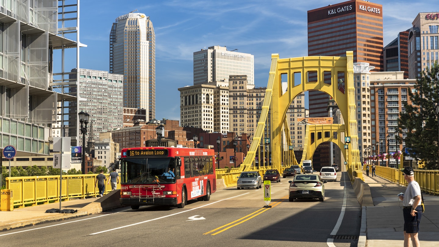
At about half the size of its cross-commonwealth neighbor Philadelphia, Pittsburgh is a walkable Pennsylvania city with loads of transportation options.
You can ping back and forth from some of the city’s most prominent landmarks, including the stadiums, museums, and parks, by foot, though the traffic-heavy city can be more difficult to navigate by car. Finding street parking is a challenge, and garages fill up quickly on weekdays when people commute for work. However, there are effective ways to get around Pittsburgh.
Navigating Pittsburgh in a Car
Taking public transport or walking often gets you to your destination faster than driving, although car rental agencies are plentiful in the area.
The biggest frustration is traffic. The city is one of the most congested in the country, and although traffic volume dipped around the pandemic, it has generally been on the rise in recent years. You may encounter significant delays, especially in the busiest areas of Interstate 376 to the airport and Route 28 to Etna/Highland Park/Aspinwall.
Many streets are quite narrow, making it a tight squeeze to navigate alongside on-street parking. Consequently, finding parking can be challenging throughout Pittsburgh’s 90 neighborhoods.
In the residential areas, it’s common to see locals mark their parking spot with a “Pittsburgh parking chair.” Be cautious; people typically do not take kindly to having their chairs removed or spots taken. Garages present a better option, as many offer discounted parking at night and on weekends. Additionally, you can use the ParkPGH app to find parking.
When driving on freeways or through tunnels, beware of drivers who abruptly stop in short merge areas or tunnel entrances instead of blending into the flow of traffic – something that can catch visitors off guard.
Taxis and Rideshare Options
Lyft and Uber have gained significant popularity in Pittsburgh since their launch in 2014, leading to the phasing out of the Pittsburgh Yellow Cab, which had been serving the area since 1913. The Pittsburgh Transportation Group has since relaunched as zTrip, an app-driven service.
The rideshare services remain popular, with thousands of drivers operating in the area, making for convenient on-demand transport for residents and visitors alike.
Bus System: A Great Way to Get Around
The city’s bus system provides extensive coverage, with around 700 buses servicing over 7,000 stops throughout Allegheny County. For example, to travel from Downtown to Pittsburgh International Airport, the best option is the 28X-Airport Flyer. Additionally, if you’re looking to visit the East End neighborhoods, such as Swissvale or Shadyside, taking the bus is highly recommended.
Real-time updates and alerts for local public transit are accessible using TransitApp and Moovit.
Light Rail: Ideal for Short Trips
The Port Authority operates the light rail alongside the bus system. The Light Rail is perfect for shorter journeys, allowing travelers to access neighborhoods just beyond walking distance. Notably, the rail system stops at popular locations including sports stadiums and Rivers Casino.
Travelers can enjoy free rides between the First Side and North Shore stations, and children up to age five can ride for free system-wide when accompanied by a paying adult, which makes this an attractive travel method for families.
When using the Light Rail, it’s important to note that you must pay after riding if you are traveling away from Downtown and pay before riding if heading downtown. Look for overhead signs along the tracks to determine the direction of the train, as audio announcements also provide guidance.
Exploring Pittsburgh by Foot
One reason many people in Pittsburgh opt to walk rather than use public transport is that it often proves to be faster, especially since sidewalks are abundant throughout the city. You can traverse from one end of Downtown to the other in less than half an hour. Moreover, the Fort Pitt and Fort Duquesne bridges feature dedicated pedestrian walkways.
Enjoy Scenic Views with the Inclines
The funicular railways, commonly known as inclines, are one of the unique ways to travel in Pittsburgh, offering stunning views while connecting you to the top of Mt. Washington.
These incline cars operate every 15 minutes throughout the day. While their practical use is limited (they connect only two locations), they provide a memorable experience for sightseeing and dining.
Bike Rentals for Neighborhood Exploration
Bike commuting has doubled over the past decade in Pittsburgh, with ongoing efforts to enhance biking infrastructure. The bike-share program, now known as POGOH, offers 38 stations and a fleet of 350 bikes, including electric-assist options.
Renting a traditional pedal bike costs $3.50 per 30 minutes, while e-assist bikes are available for $5 for the same duration. Downtown features designated bike lanes, making it easier to navigate without dealing with heavy traffic. However, availability of bike parking can be an issue during peak summer months when outdoor dining spaces are in high demand. Hence, using bike shares with dedicated stations might be the most practical choice.
Accessible Transportation Options
For those requiring advanced-reservation transportation, ACCESS offers services across Allegheny County with a fleet of over 300 vehicles. To arrange a ride, call (412) 562-5353 or utilize Relay 711.
Rideshare services may pose challenges for individuals with mobility devices; it’s advisable to confirm accommodations in advance and to book early to account for any potential delays.
Transport Passes for Convenience
A Port Authority ConnectCard acts like a debit card for travel throughout the city. It can be purchased at the Downtown Service Station or at any Downtown light rail station, with the option to add funds as needed. Using the ConnectCard results in a small discount on one-way trips on light rail and buses compared to cash payments.


