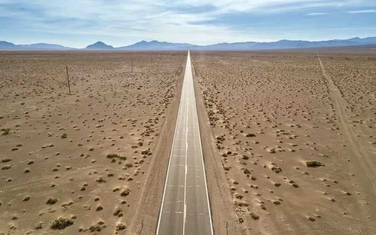
One of the most amazing views in Nevada can be found beyond the Las Vegas Strip — out in the Mojave amid the red rocks and dusty nothingness. The 370-mile Death Drive is one of the state’s best road trips, showcasing some of the most beautiful views Southern Nevada (and Eastern California) has to offer.
This route will guide you to some of the best natural parts of the state and is also fairly convenient to get to. The loop takes drivers from Las Vegas to Death Valley and back again.
Note that before you head out on this drive, you should always check road conditions through the National Park Service. Closures are sometimes unavoidable and could severely impact your trip.
Ready for Death Drive? Here’s a full itinerary with all the best views and strange roadside attractions to stop for.
Las Vegas to Pahrump

Begin by heading west out of Las Vegas on State Route 159, stopping to explore some stunning Red Rock Canyon at Spring Mountain Ranch State Park, about a half hour from the city. After getting your fill of the vividly colored geological wonder (don’t worry, there’s plenty more to follow), road trippers should continue their journey on State Route 160 toward Pahrump. The drive from Las Vegas to Pahrump, without stops, takes about an hour and 10 minutes or up to an hour and 45 minutes in traffic.
Once you reach Pahrump, you’ll have earned a bit of rest and refreshment. Thankfully, this little desert town is home to one of Nevada’s best biker bars, Mountain Springs Saloon. If the first leg of the journey puts you more in the mood for a rosé than a well drink, great wines can be found at Pahrump Valley Winery or Sanders Family Winery. The former offers a hearty lunch menu, and you’ll want to get your belly full before heading onward towards Death Valley National Park.
Pahrump to Death Valley National Park

After hopping back in the car, veer off Route 160 to Bella Vista Road. Make a quick pitstop at the quirky coffin-themed roadside shop, Coffin It Up, just outside Pahrump, to get a fear fix (and some spooky souvenirs) before continuing towards Death Valley Junction.
By the time you reach Death Valley Junction, you will have crossed the border into California, which claims most of this vast and remote national park. Its namesake junction is about a 40-minute drive from Pahrump, and if your legs could use a stretch, the Amargosa Opera House is a great opportunity.
The opera house is an eclectic and supposedly haunted 1920s-era hotel and performing arts venue built in the Spanish Colonial Revival style. Stop for a cold drink inside the retro Amargosa Cafe, open seasonally Friday to Monday, or take a moment just to admire the decor on a tour, offered year-round.
From the junction, California State Route 190 will lead you into Death Valley, the hottest, driest, and lowest part of the U.S. and the highlight of Death Drive. Get a sense of the three-million-acre playground by first stopping at Zabriskie Point, along 190, to take in the badlands and salt flats that stretch toward the impressive Panamint Mountains. Next, follow 190 to Badwater Road, which leads to Artists Drive. This nine-mile loop showcases the breathtaking watercolor rock formations known as Artists Palette.
By this point, you will have driven about three and a half hours from Las Vegas and stopped numerous times to soak in the sights of the beautiful Mojave Desert. If you find you need a place to hang your hat for the night, the Oasis at Death Valley provides just that — an oasis — along Route 190 between Zabriskie Point and the turnoff to Artists Palette.
Beatty Back to Las Vegas

Eventually, drivers can head out of Death Valley National Park via Daylight Pass Road, a fully paved mountain pass offering incredible views of the desert and surrounding rugged peaks. This road is about 10 miles long, and you want to take the turns gently. At the Nevada border, it turns into State Route 374. Hang a left onto Rhyolite Road shortly after passing the Death Valley National Park sign for a tiny detour to one of the most famous “ghost towns” in the state.
Just off the route, on a road unofficially called Golden Street, is also Goldwell Open Air Museum, showcasing some truly unique and free-to-see artworks. Stop there before hitting Rhyolite, where you’ll see some of the remnants of a bygone civilization — what’s left of a bank, jail, train depot, and bottle house. Then hop back on 374 to Beatty.
Beatty is a small town where you can fuel up the car and restock your road trip snacks before completing the second half of the Death Drive loop, a less-attraction-filled leg that will lead you back to Vegas. From Beatty, you’ll follow U.S. Route 95 for about 117 miles — about an hour and 45 minutes — straight into Sin City.
Travelers will pass through the scenic region surrounding Charleston Peak, where you might actually catch a glimpse of snow on the mountain, depending on the time of year. Rising nearly 12,000 feet above sea level, this is one of Nevada’s tallest peaks.
After a very long day or couple of days on Death Drive, no one would blame you for indulging in a buffet or treating yourself to one of the best hotels in Las Vegas for the night. A massage and room service at the Four Seasons, anyone?


