Summary
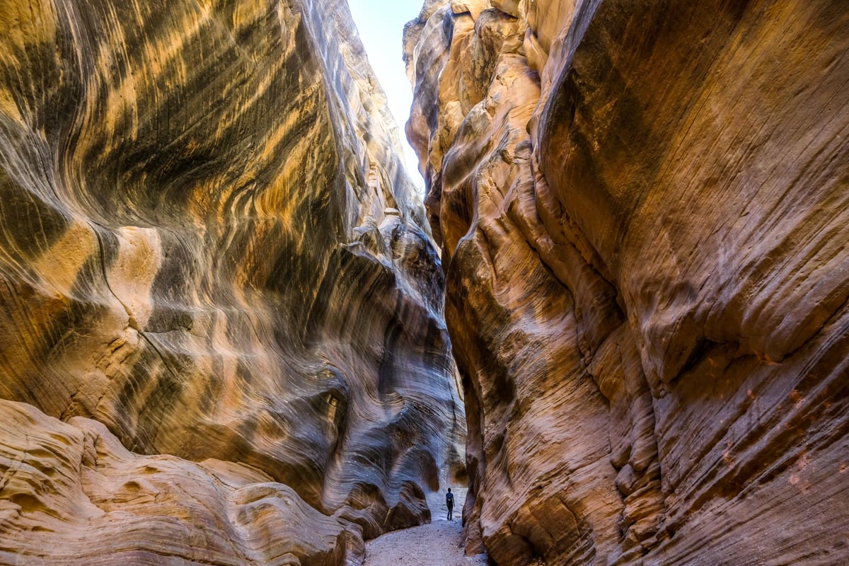
The Willis Creek Slot Canyon is a short and easy trail through some scenic narrows in southern Utah, featuring wavy, vanilla-colored rocks and impressive passageways. This hike is very family-friendly, located less than an hour from the popular Bryce and Escalante areas, making it a perfect addition to your road trip through Utah!
Quick Facts
- Distance: 3+ miles (5+ km) round trip
- Elevation Loss: 175 feet (50 m)
- Duration: 1.5+ hours round trip
- Difficulty: Easy

Willis Creek Slot Canyon: What To Expect
As you traverse the Willis Creek Trail, you will encounter various landscapes. Some sections feature a more open riverbed, while others resemble a true slot canyon, offering dim lighting and steep, narrow walls. The adventure begins just 250 feet from the trailhead parking, across the road from the parking area, as you follow the wash into the canyon.
The entire trail is straightforward and fairly flat, which makes it one of the easiest and most family-friendly slot canyon hikes available. At around the 1/2 mile mark, be ready for a tall drop-off—however, it’s simple to navigate around it. Additionally, a shallow stream may run through the canyon, but it’s typically shallow enough to cross without getting wet.
During our visit on a weekday, we encountered only a few hikers and horses, making for a peaceful experience, despite some horse droppings to watch out for.


The most stunning slot section is found near the 1-mile mark, displaying a dark, steep passageway adorned with wavy, vanilla-colored rock walls. Most of our photos were taken in that captivating section. Generally, visitors may wish to turn around after approximately 1.5 miles at the T-junction with Averett Canyon, as you’ll have already experienced the canyon’s most breathtaking views. Although you can continue right and venture as far as 3 miles to Sheep Creek, the scenery doesn’t remain as remarkable as earlier portions.
Trailhead Location For Willis Creek Canyon
The Willis Creek Canyon trailhead is situated outside of Cannonville, Utah, and is conveniently located near both the Bryce and Escalante areas. The GPS coordinates are: 37.48367148543457, -112.09733707849618. You can click this link to open it in maps and navigate directly to the parking lot, which is roughly a 1-hour drive from either location. The trailhead is directly across the road from the parking area.
Trailhead Conditions
The final stretch of the drive to the Willis Creek trailhead involves 20 minutes on a bumpy back road (BLM500/Skutumpah). This washboard dirt road features several steep sections that might pose challenges for some vehicles; however, we managed fine with a 2WD. The road had no major potholes, so most vehicles should be able to navigate it, provided the road is dry. Avoid this route after rain!
The parking lot is equipped with informative signs, a simple trail map, and ample parking space, though there are no restroom facilities. Please remember to keep the trail clean and respectful of fellow hikers during your visit to the Grand Staircase-Escalante National Monument, which is managed by BLM. Remember to follow the leave no trace principles for a better outdoor experience.


Slot Canyon Safety Tips
Flash Floods: Always be aware of the weather forecast. Do not enter any slot canyon if rain is expected, even if it’s not in your immediate locale, as flash flooding can be extremely dangerous.
Sunscreen: Even while hiking through slot canyons, there are portions of the trail exposed to direct sunlight; therefore, applying sunscreen is advisable.
Water: Aim to pack at least 3-4 liters of water per person. It’s critical to carry more water than you believe you’ll need while hiking in Utah.
Map: Downloading an offline map using an app like Google Maps is wise, as this will allow you to navigate or determine your position even without cellular reception. Getting lost in the desert can be perilous.
Where To Stay In Escalante


More Things To See Nearby
Willis Creek Slot Canyon is conveniently located near Bryce and Escalante in southern Utah, allowing access to numerous attractions. We hiked this trail as a delightful detour while traveling from Bryce to Escalante—it’s just a brief side trip off the main road connecting the two towns. You could also combine your visit to Willis Creek with a trip to Kodachrome Basin State Park, which is only a 30-minute drive away.
Best Utah Tours
More Utah Slot Canyon Guides
Thank you for reading! We hope this guide to the Willis Creek slot canyon hike near Escalante, Utah has inspired you. Enjoy exploring our complete Utah Slot Canyon Guide for additional exciting destinations!


